| Ma On Shan | |
| Distance: 7.5 Km | |
| Duration: 4.5 hours | |
| Diff.: | |
| Scn.: | |
Due to Google changing the terms of Google Map, the daily usage rate will be limited. Please refer to the static map instead if the above map could not be displayed or used normally. I apologize for the inconvenience.
 Static Map
KML file
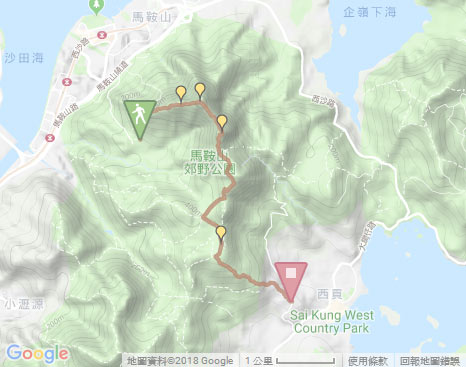
Tiu Shau Ngam to The Hunch Back (Ngau Ngak Shan)
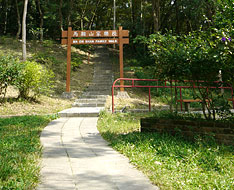
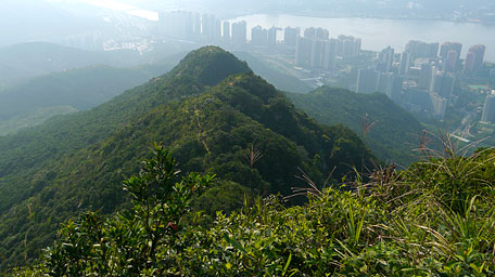
Getting off at Ma On Shan Barbecue Site beside Ma On Shan Tsuen Road and then passing through the carpark, the trail starts by following Ma On Shan Family Walk until the pavilion with a view over Shing Mun River of Sha Tin. Afterward, follow the path behind the warning notice by the pavilion, it leads up to the junction of Wild Goose Valley Path on the left which is a horizontal path winding along the north hillside of Tiu Shau Ngam. Ascend the steep path by the second warning notice on the right, it contours along the ridgeline. It is very steep in the initial section that would require clambering. There would be some ropes or strings lying on part of the steep slopes for assistance, but be not too dependent on them. Up ahead, the trail undulates upwards over several sprawling massifs and sometimes cuts through the woods in part.
Note : The strenuous climbs up are required for Tiu Shau Ngam!
Related Route: Wild Goose Valley Path
Along the way, you could overlook the valley in the north hillside of Tiu Shau Ngam named ‘Goose Valley’ which consists of the several hollows and ridges forming a complicated terrain. There are some famous places for the advanced hike, such as Kam Mo Kau valley (means Cibotium barometz), Ape valley and Golden Wall ridge. The trail also passes through the junctions for the accesses to them.
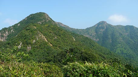
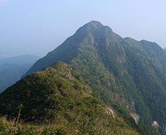
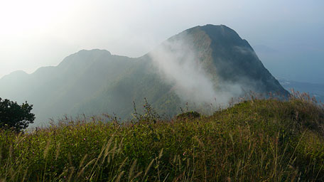
Continue on along the trail up. After trekking over the hillsides and climbing the last steep slope, it leads to the summit of Tiu Shau Ngam. Overlook to the north, it offers the splendid views over Tolo Harbour, Ma Shi Chau and Pat Sin Leng. Looking to another way, the saddle between The Hunch Back (as tail) on the left and the main peak of Ma On Shan (as head) on the right seems to be a huge drawbridge emitting mighty aura. The hillside below the saddle is named West Horse Belly. Continue to head the trail, it follows the ridge westward. After the slow descent, it begins uphill. Passing through the narrow path and cutting through the woods, it pushes you to the hilltop of The Hunch Back.
Ma On Shan
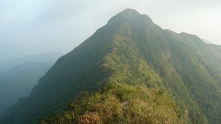
Head the trail along the saddle toward the southeastern main peak of Ma On Shan, it is initially slow down then becomes uphill through the gentle slope contouring the ridgeline along the cliff edge in part. Afterward, it comes to the summit of Ma On Shan. You could look back to the sublime scenery over the rugged contours of the rolling hills as billows between Tiu Shau Ngam, The Hunch Back and even Ma On Shan that you have trekked. Gazing to the east and the southeast, it also gives the majestic views over Three Fathoms Cove and Sai Kung Hoi respectively. In additions, Sha Tin and Tolo Harbour also come into full views from the west and northwest. Sometimes you are surrounded among the clouds.
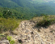
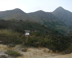
Continue to follow the trail downhill roughly southwards, it turns right at the first warning notice then goes down to the left at the second warning notice. At the initial section, it is steeply down through the craggy rocks. Along the way, a deep valley named Horse Chin Valley could be seen on the left, which is one of the accesses to join Skyline Path and Elephant Gate where are both the very precipitous places. After scrambling down, the terrian tames a little. Along the ridge, MacLehose Trail lying on the upland could be seen on the left down in the distance. Head to the next warning notice, deviate from the ridge by taking the steep downhill path on the left which covers with loose gravel. After climbing down steadily, it leads to the valley and joins MacLehose Trail.
Nong Ping to Tai Shui Tseng
Trace MacLehose Trail to the right roughly towards the south to Nong Ping (left to Shui Long Wo). There is an upland terrain and also a popular place of playing parachute. Along the trail, it offers a spectacular full view over Sai Kung Town and Sai Kung Hoi. After skirting the hillside of Pyramid Hill and further going ahead, it comes to the crossing of Ma On Shan Country Trail. Follow the trail to the left according to the signpost to Tai Shui Tseng (right to Ma On Shan Tsuen), it then passes through the tableland of Ngong Ping and the camping site nearby. Head to the junction with the map board, then follow the left path downhill leading to Tai Shui Tseng. Overlooking Sai Kung Town on the way, it leads down to Pak Kong Au Road. Finally along it going down, you could take minibus to Sai Kung Town at the junction of Po Lo Che Road.![]()
Related route:Pyramid Hill
Summary
The trail is difficult for the strenuous climbs along the undulated ridge. However, you could see the spectacular views at the peaks and feel mighty aura of Ma On Shan and The Hunch Back with rugged ridges of the rolling hills. It is also unforgetable that along the saddle the sublime scenery from Three Fathoms Cove, Sai Kung Hoi and Sha Tin comes into eyes at the moment.
Establish : 29.01.2015 / Last Update : 13.08.2017
Suggestions:
Other Informations:

