| Sunset Peak | |
| Distance: 8.0 Km | |
| Duration: 4.0 hours | |
| Diff.: | |
| Scn.: | |
Due to Google changing the terms of Google Map, the daily usage rate will be limited. Please refer to the static map instead if the above map could not be displayed or used normally. I apologize for the inconvenience.
 Static Map
KML file
Wong Lung Hang Road
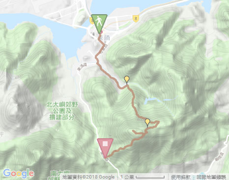
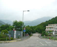
The trail starts from Tung Chung Railway Station. It follows Tat Tung Road and then turns left at the junction of Shun Tung Road. Passing through the subway at the junction of Yu Tung Road, it comes to the Lantau North Police Station. Go ahead along Yu Tung Road, then cross it by taking the pedestrian bridge to the left side. Afterward, tracing Tung Chung Road to the right with a short distance, it arrives at the entry of Wong Lung Hang Road on the left. Follow Wong Lung Hang Road, it winds through the valley with the slow ascent. Passing through the entry of Chek Lap Kok New Village and further going ahead, it comes to Wong Lung Hang Picnic Site.
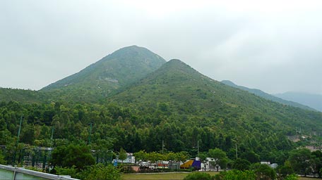
The hill of Pok To Yan
Wong Lung Hang Country Trail
From the entrance of the picnic site a few steps ahead, the trail follows Wong Lung Hang Country Trail uphill on the right. It initially ascends the long and steep flight of stone steps along the north slope of Sunset Peak. After the steep climb, it comes to a small flat land on the hillside like an open natural lookout. Overlook to the north, Tung Chung and the airport could be seen. Move the sight to the right, the undulated hill of Pok To Yan and the hills of Sam Shan Toi and Lin Fa Shan like a broad screen, are traceable to the same stock. In the background of Sunset Peak, you are surrounded by the ring-shaped hills.
Continue to head the trail uphill, the slope turns tame. Look up to the summit of Sunset Peak, it is sometimes covered with clouds which make it to be mysterious. Afterward, it cuts through the forest. The woods are verdant and lush, part of the path becomes gloomy and moist slightly. Beyond the forest, the top of the hillside could be seen. Up to the junction of Lantau Trail, trace it to the right towards Pak Kung Au according to the signpost. (Heading the left path could be leaded to Mui Wo via Sheung Tung Au and Nam Shan)
Related trails: Sunset Peak II | Lin Fa Shan
Sunset Peak
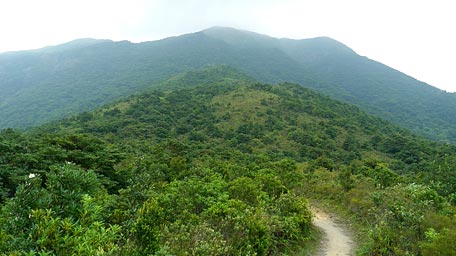
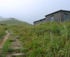
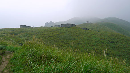
Follow Lantau Trail, it is gently up by contouring along the undulate ridge. Along the way, you could see the famious view spot at the stone chalets distributed on the hillsides of Sunset Peak. Passing the signpost L014 of Lantau Trail, take the side path on the right that leads to the summit of Sunset Peak. The uphill path is rough, narrow and overgrown with weeds in part. After around 15mins climb, it comes to the range pole at the hilltop. Looking around, it gives splendid views over the coast of Cheung Sha, the south of Lantau Island and the rolling hills of Yi Tung Shan. In additions, the soaring hill of Lantau Peak is just towering on the west. Afterward, retrace your steps back to the Lantau Trail then continue on along it to the right downhill that winds along the west slope. After the long downhill path, it finally leads to the pavilion at Pak Kung Au.![]()
Branch: You could still follow Lantau Trail downhill if not climb to the top of Sunset Peak.
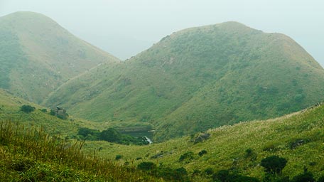
A pool in the valley
Summary
It is quite physically demanding from the ground level climbing up to eight hundreds meters more in height. It however offers a very broad and splendid view from the hilltop as well as the different seasonal scenery such as sea of clould, sunrise and the silvergrasses distributed full on the hillsides. The nature is not a place where is gorgeous, sparkling, clean and spotless like a perfect aseptic room, but it is full of vitality, vivacious, and spiritual which always let you to be relaxed and satisfied.
Establish : 14.10.2011 / Last Update : 27.08.2018
Suggestions:
Other Informations:

