| Sunset Peak II | |
| Distance: 9.0 Km | |
| Duration: 4.0 hours | |
| Diff.: | |
| Scn.: | |
Due to Google changing the terms of Google Map, the daily usage rate will be limited. Please refer to the static map instead if the above map could not be displayed or used normally. I apologize for the inconvenience.
 Static Map
KML file
Mui Wo to Nam Shan
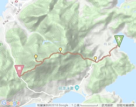
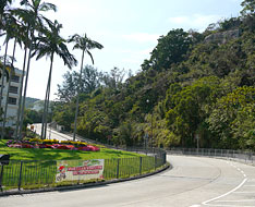
From Mui Wo Ferry Pier, head the pavement on the right. At the roundabout, join South Lautau Road on the left. The trail begins a slow ascent along the pavement with a roadsign to Nam Shan. Afterward, on the right it offers a scenic view over the broad depression of Mui Wo with rustic hamlets beneath Lin Fa Shan. Head the trail, it winds up then comes to the entry of Lantau Trail section 2 on the right at Nam Shan.
Sheung Tung Au
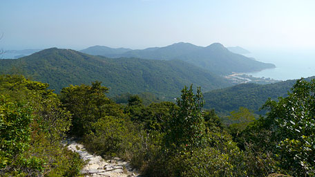
Along Lantau Trail, it is a wooded smooth path in the beginning. Passing the helipad, it starts a long flight of stone steps uphill then winds alone the hillside roughy towards the west. Up ahead, a grand view could be seen southwards to Lo Yan Shan, farther Tai Ngau Wu Teng (Pak Fu Tin Shan), and Pui O beach lying beneath them. Further up, Hei Ling Chau and even Hong Kong Island are also within the sight from the west. Up to Sheung Tung Au, a recess between the range of Sunset Peak and Lin Fa Shan, the trails becomes smooth. Over the recess, you could overlook Tung Chung and the airport hustling anytime in contrast to the southern peaceful Pui O. At the moment, the crest of Lin Fa Shan is on the right. At the fork, there is a rough side path on the right access to its hilltop if you want.
Related route:Lin Fa Shan
Sunset Peak
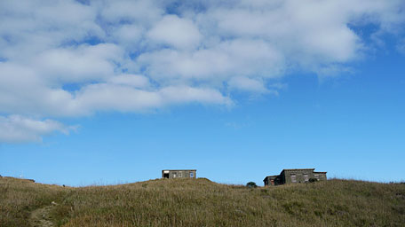
Continue on along the Lantau Trail. Passing through the junction of Wong Lung Hang Country Trail on the right and heading forward, the stone chalets distributed on the ridge could be seen. It is interesting that the cabins seem to be orderly built on each small hillsides. Head the trail upwards through the gentle slope. Beyond L014 of the roadsign, take the side path on the right at the fork that leads to the hilltop of Sunset Peak. It is narrow, rough and overgrown with weeds in part that winds along the hillside. Up to the upland, go ahead then arrive the summit.
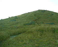
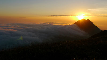
Standing at the top, you are enclosed among the sublime scenery. Northwards to Tung Chung and southwards to the long coastline of Cheung Sha could be seen at the time. In additions, lofty Lantau Peak are towering on the west. Suddenly, the cloud layer became thick and gradually covered the hillsides and the ridges beneath the hilltop around, like huge slow streams tumbling over cascades along the slopes, and finally formed the sea of cloud. At the sunset, Lantau Peak only expose its summit a bit as a tower spire above the golden cotton. It was the most stunning natural scene during the hike. Retrace the steps down to the Lantau Trail, then turn right and follow it towards the west. After skirting the hillside, it winds steeply down westward along the ridge and goes to the pavilion of Pak Kung Au.![]()
Related route:Sunset Peak
Summary
Climbing up the soaring Sunset Peak, I enjoyed the splendid views over Lantau Island. However, being able to see the fantastic scene on the sea of cloud at the sunset by chance was a wonderful experience for me as an extra reward during the jounery.
Last Update : 02.02.2015
Suggestions:
Other Informations:


