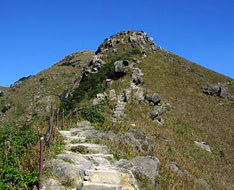
| Kau Nga Ling | |
| Distance: 8.0 Km | |
| Duration: 5.0 hours | |
| Diff.: | |
| Scn.: | |
Start: Bus 11,23 from Tung Chung, get off at Shek Pik Reservoir
End: All Buses to Tung Chung, Mui Wo or Tai O
It is a precipitous trail that requires to scramble over the steep rocky slopes along cliff edges in part, suitable for advanced hiker.
At Tsam Chai Au, if not climb the summit of Lantau Peak, your could take the Lantau Trail to the left leading down to Ngong Ping.
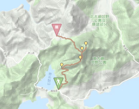
Due to Google changing the terms of Google Map, the daily usage rate will be limited. Please refer to the static map instead if the above map could not be displayed or used normally. I apologize for the inconvenience.
 Static Map
KML file
Shek Pik Country Trail
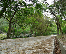
From the bus stop of Shek Pik Reservoir toward the way to Mui Wo, follow South Lantau Road for about five minutes walk to the gate of Tong Fuk catchment on the left. Pass through the gate and go ahead along the concrete path. After crossing the catchwater through the short bridge, it comes to the beginning of Shek Pik Country Trail. Head the trail, it slowly ascents the flight of steps, then follows the gentle path. Along the way, the scenic view over Shek Pik Reservoir could be seen from another view point. Many pines are vegetated on the hillsides, there are also some pinecones on the ground. After winding along the hillside at about an hour walk, at the right turn, it comes to the entrance of the path to climb the west ridge* of Kau Nga Ling on the right rocky slope with a warning notice stood.
* There are three branches of the hill ranges of Kau Nga Ling which are west, middle and east ridge respectively.
Note: It is required to clamber up strenuously along the ridges!
West ridge of Kau Nga Ling
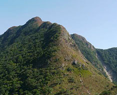
Follow the right path, it contours along the undulated ridge uphill. Most of the slopes are very steep that requires clamber up strenuously. After climbing several steep slopes, it turns gentle and passes through a shrubbery on the hillside. Overlooking to the left, the huge buddhist statue is sitting on Ngong Ping. Toward the right, the middle ridge of Kau Nga Ling rolls and billows. Looking up far forward, the grand steep southern slope of Lantau Peak with mighty aura, named as "the Wall of Hell King", could be seen. Gaze back, it offers the splendid view over Shek Pik Reservoir and the south coast.
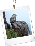
Continuing on along the trail, it starts the most steep and precipitous path along the cliffy escarpments on the both side in part. The section of the ridge is like a knife blade, so be careful to climb them. After the strenuous climbs, it leads to the hilltop of Kau Nga Ling. There is also a junction of the west ridge and the middle ridge of Kau Nga Ling. At the junction on the right, there is a large rock at the beginning of the middle ridge, named as “A Gleam of Hope" by hikers (as indicated in the heading picture), because the hikers could only pass it one by one. As the trail is to climb Lantau Peak ahead, it will not pass "A Gleam of Hope".
Head the trail, after the gentle descent, it sharply turns up to climb the slope of "the Wall of Hell King". It is quite steep but slightly tames down later. Up ahead, the trail passes the rock on the right which shape is like a tortoise (Bird Rock), and where is also the entry to access the south slope of Lantau Peak. Further up, it soon comes to Tsam Chai Au and joins Lantau Trail.
Related route : The south slope of Lantau Peak
Tsam Chai Au and Lantau Peak
Follow Lantau Trail to the right uphill. After climbing Lantau Peak, retrace the way to Tsam Chai Au, then contiue on along Lantau Trail ahead downhill. It descents the long flight of stone steps and then leads down to Wisdom Path. Afterward, according to the signpost, follow the concrete path to the bus terminal in Ngong Ping.![]()
Exit: At Tsam Chai Au, if not to climb Lantau Peak, you could follow Lantau Trail to the left leading down to Ngong Ping.
Branch: At the hilltop of Lantau Peak, you could also trace Lantau Trail ahead that descends to Pak Kung Au.
Related route : Lantau Peak
Summary
The undulating spurs of Kau Nga Ling rears up that has the considerable cliffy escarps and the jagged rocks, and therefore it is known as the most arduous hill in Hong Kong. Climbing along its ridges seems to overcome the wind and the billows. However, it is indescribable for the greatest satisfaction after conquering the precipitous target. Perhaps, the most difficult hill is just existing in heart.
Last Updated : 05.09.2015
Suggestions:
Other Informations:

