| Tiu Tang Lung | |
| Distance: 11.0 Km | |
| Duration: 5.5 hours | |
| Diff.: | |
| Scn.: | |
Due to Google changing the terms of Google Map, the daily usage rate will be limited. Please refer to the static map instead if the above map could not be displayed or used normally. I apologize for the inconvenience.
 Static Map
KML file
Wu Kau Tang
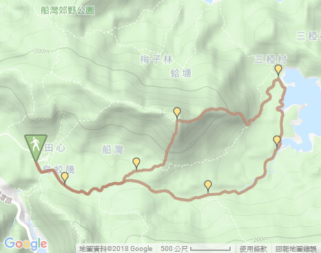
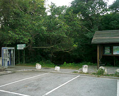
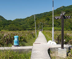
The trail starts from the the concrete path on the left of the pavilion with a map board beside the carpark at the end of Wu Kau Tang Road. Along the path down, turn left soon at the junction to Sam A Tsuen. At the next fork, take the right path to Kau Tam Tso according to the signpost. Head the trail, then take the upper left fork at the junction after joining the muddy path. (Taking the right fork ahead could also go to Sam A Wan via Sheung Miu Tin, Ha Miu Tin and Sam A Chung.)
Tiu Tang Lung
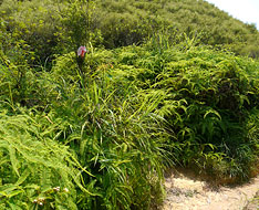
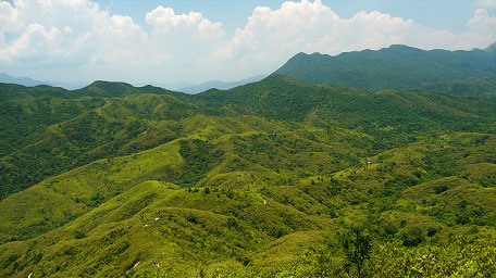
Follow the trail up, the majestic wide hill range of Tiu Tang Lung is just towering on the left front. Not far ahead, its precipitous southern slope could be seen. Head to the foot of the south slope, then take the left side path with a warning signpost and some ribbons as a mark at the entry. The path is obvious and climbs sharply upwards that pushes to the top. In the beginning, passing through an electric pole, it starts uphill and becomes steep gradually that requires to clamber. Further up, looking back far, the rolling hills and the winding criss-cross ridgelines with a jade screen feast your eyes.
Note: The uphill path is very steep and would require to clamber up.
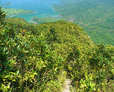
After a steep climb, it comes to a small flatland and the slope becomes gentle. Looking wide around, you could see the lofty mountain ranges. Pat Sin Leng and undulated Wong Leng which range links up Pat Sin Leng are towering at the southwest. Gazing southward, the hill ranges of Wang Leng Au and Tai Tung horizontally lying down as a long screen are also within sight. Afterward, continuing on along the path, it leads up to the hilltop. At the top overlooking toward the east, you could see that the red rocky shore, the greenish mangroves, the winding delicate coastline, the water surface as a mirror, all fashioned an amazing and spectacular scenery for Yan Chau Tong.
Looking far southeast to Crooked Island, it offers the peculiar and unique views over four of the six view spots from Yan Chau Tong. They symbolize six treasures* in china respectively, four of which are Yan Chau like a jade seal of emperor, Pak Shi Tau Tsui as a pen point, Pak Ka Chau like a pen rack and smooth water surface as a paper.
* Part of the treasures are symbols of the ancient stationery for study in China, such as the writing brush, ink-stone and paper.
Sam A Wan
Head the trail down a short distance toward east, it comes to a small flatland. There are two downhill paths. Take the right path along the east ridge downhill which entry is overgrown and faces far to Sam A Chung and Hung Shek Mun. (The left path toward Lai Chi Wo could lead down to Lai Chi Wo via Ha Tong along the north slope.) Along the path down, it is narrow, overgrown but obvious. Along the way, a full view on Sam A Wan could be seen. After descending beyond the several hillsides, it becomes fairly steep. You could clamber down if required. Passing through a electric pole, it joins to the main path (Lai Sham ancient path) of Lai Tau Shek. Head the trail to the left, it leads to Sam A Wan and then comes to the cross-junction of Sam A Tsuen. At the junction, going ahead to the pier (taking the left fork could lead to Lai Chi Wo), it gives a picturesque nature scene over the coast of Sam A Wan.
Branch: From the hilltop of Tiu Tang Lung, other than the downhill path along the east ridge, you could take the west path along the ridge of Fan Kei Tou then follow the left path down to Wu Kau Tang at the junction. Alternatively, take the steep path along the north slope down to Lai Chi Wo via Kop Tong, but it slightly obscures and requires to cut through a forest.
Exit: After the downhill from Tiu Tang Lung, you could follow the path to the right to Wu Kau Tang if not go to Sam A Wan.
Sam A Chung and Sheung Miu Tin
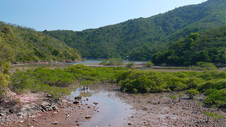
Back to the cross-junction from the pier, take the left fork to Wu Kau Tang via Sam A Chung and Sheung Miu Tin. Along the shallow shore, you could see the mangroves grows on the wetland with brackish water in Sam A Chung, which nurture many species then fashion the vital nature. Passing through the sylvan terrain, it comes to Ha Miu Tin. Alongside the stream, it leads to Sheung Miu Tin. Head the trail, then return to the junction that passed before. Go ahead along the original way. After joining the concrete path, via Kau Tam Tso it returns to the minibus station of Wu Kau Tang.![]()
Related route: Sam A Wan
Summary
Climbing up Tiu Tang Lung along the south ridge is very steep but the shortest way. I think the best place to overlook the full view on Yan Chau Tong and its splendid scenery is only at the summit of Tiu Tang Lung.
Last Update : 04.05.2015
Suggestions:
Other Informations:


