| Sam A Wan | |
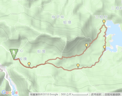
| Distance: 9.0 Km | |
| Duration: 3.0 hours | |
| Diff.: | |
| Scn.: | |
Start: Minibus 20R from Tai Po Market Railway Station, get off at Wu Kau Tang
End: Minibus 20R to Tai Po Market Railway Station
Due to Google changing the terms of Google Map, the daily usage rate will be limited. Please refer to the static map instead if the above map could not be displayed or used normally. I apologize for the inconvenience.
 Static Map
KML file
Wu Kau Tang
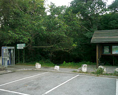
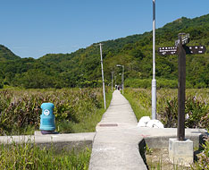
The trail starts from the the concrete path on the left of the pavilion with a map board beside the carpark at the end of Wu Kau Tang Road. Along the path down, turn left soon at the junction to Sam A Tsuen. At the next fork, take the right path to Kau Tam Tso according to the signpost. Head the trail, it goes forward at the junction after joining the muddy path. (Taking the upper left fork could also go to Sam A Wan but via Lai Tau Shek.)
Sheung Miu Tin and Ha Miu Tin *
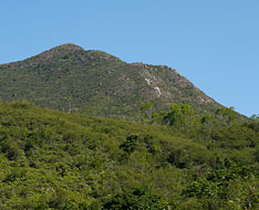
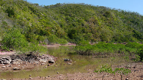
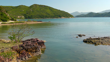
Follow the sylvan path that heads generally east. Along the way, the range of Tiu Tang Lung is towering at your upper left. Beyond Sheung Miu Tin, it winds alongside a brook. There are also some abandoned ancient houses near Ha Miu Tin. Head the trail, it comes to Sam A Chung with a camping site. You could see the transparent water from the stream and the mangroves along the shore. Moreover, the rock on the ground appears in red like that in Hung Shek Mun. After skirting along the shore, it arrives at Sam A Wan within Yan Chau Tong Marine Park.
* Sheung Miu Tin and Ha Miu Tin were two ancient villages in the past.
Sam A Wan
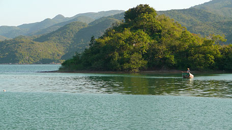
Along the coast going ahead, it comes the cross-junction of Sam A Tsuen after joining the concrete path. By taking left fork or heading not far ahead (the way to Lai Chi Wo), you could have lunch or replenish something in the restaurants there. Taking right fork to the pier, it offers a picturesque nature scene over the coast of Sam A Wan. The mongroves, the shallow inlet and the water plane as a mirror fashion a sublime landscape.
Wu Kau Tang via Lai Tau Shek
Go back to the cross-junction and take the way to Lai Tau Shek. Passing through the restaurant of Sam A Tsuen, it becomes uphill. The trail winds gently up along the hillside (also named Lai Sam Ancient Road for the section). Along the way toward south, the undulated ranges of Wang Leng Au and Tai Tung could be seen. Tiu Tang Lung on the upper right is also within the sight. There are some abandoned ancient houses and you could also see a grindstone on the ground. Afterward, it leads down to the junction and joins the path that passed before. Along the path to the right to retrace your steps, via Kau Tam Tso, it returns to the minibus station of Wu Kau Tang.![]()
Alternative: You could retrace your way via Sheung Miu Tin and Ha Miu Tin to return to Wu Kau Tang.
Summary
It is impressive for the picturesque natural scenery in Sam A Wan with the tranquil inlet, the smooth water surface and the mangroves on wetland along the shore. The trail is also the shortest and easiest way to Yan Chau Tong Marine Park.
Last Updated : 29.03.2015
Suggestions:
Other Informations:


