| Wo Yeung Rocky Group | |
| Distance: 11.0 Km | |
| Duration: 6.0 hours | |
| Diff.: | |
| Scn.: | |
Due to Google changing the terms of Google Map, the daily usage rate will be limited. Please refer to the static map instead if the above map could not be displayed or used normally. I apologize for the inconvenience.
 Static Map
KML file
Fu Yung Path
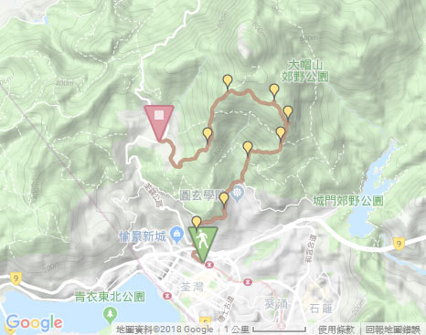
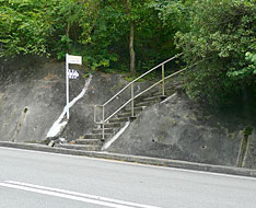
The trail starts by following the pedestrian bridge toward the way to Discovery Park from Exit A of Tsuen Wan Railway Station. Head the bridge not far, it then joins the other bridge on the right at the junction leading to Route Twisk. After crossing the railway, it ascends the short flight of steps on the left up to Route Twisk. Afterward, follow Route Twist to the left a short distance, on the opposite side, the trail begins the long flight of uphill concrete steps of Fu Yung Path until Shing Mun Catchwater.
The south ridge of Wo Yeung Shan
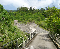
Follow the road to the right alongside Shing Mun catchwater, it winds along the hillside. Along the way, a distance view over Kwai Chung, Shek Lei and Golden Hill could be seen on the right. Head to a dam of Tai Yuen Stream on the left then further go ahead a short distance, according to the signpost for the way to Lun Mun Country Trail, it crosses the catchwater by passing the short bridge on the left, ascends the short flight of concrete steps and then soon traces the muddy path on the right. Along the muddy path, it is gently up through the woods until the junction of Lun Mun Country Trail. Afterward, by crossing Lun Mun Country Trail, it still continues to follow the uphill path at the left-front according to the signpost to Lead Mine Pass.
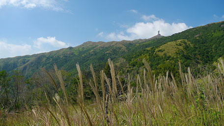
Along the uphill path, it ascends gently and the woods are lush at the initial section, then gradually turns steep and the woods more and more sparse, however it also becomes more open. At that time looking up to the left, it offers a majestic green mountain view over the south slope of Tai Mo Shan which peaks are undulating toward the west until the high ridge of Miu Ko Toi. Continuing on along the path uphill, it becomes steep in part that would require clambering up slightly. Afterward it leads up to the junction of Sheung Sze Forest Trail where has the signpost for the way back to Shing Mun Catchwater.
-
Exit: If not to climb Wo Yeung Shan,
- At the crossing of Lun Mun Country Trail, you could follow it to the right until Shing Mun Reservoir minibus station at pineapple dam, or left to Chuen Lung minibus station.
- At the crossing of Sheung Sze Forest Path, you could head it to the right leading down to the junction and take the right path to join Lun Mun Country Trail, then follow the forest concrete road to minibus station at pineapple dam of Shing Mun Reservoir.
Related route: Sheung Sze Forest Trail
Shek Tin Mun
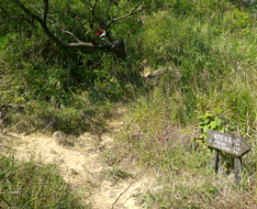
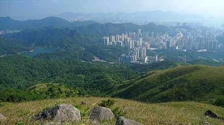
From the junction of Sheung Sze Forest Trail, follow the path ahead (northward) to climb Wo Yeung Shan which entry is obvious and has ribbons as a mark. After a steep climb, you could look back a panoramic view, left to Shing Mun Reservoir beneath Needle Hill with Lion Rock as the background, southward to Kwai Chung, Tsuen Wan, Tsing Yi and even far to Hong Kong Island. Further up, some of the large rocks distributing over the hillside could be also seen.
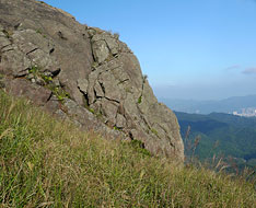
Up the trail not far, there is a large rock toward Shing Mun like a cliff on the right - Shek Tin Mun. Pay attention to the right, there is an obscure path to the top of Shek Tin Mun. Descend along the right edge of the huge rock of Shek Tin Mun, you could lead to the front of Shek Tin Mun. There is a narrow gap, like a rocky heaven gate as the meaning in chinese, near the center of the front side which could be passed through if you are confident of your figure. But its exit is narrower. Afterward, retrace the steps to the top then return to the main uphill path.
-
Note:
- The uphill path of Wo Yeung Shan is quite steep, it would require clambering.
- You could skip Shek Tin Mun.
- Down to the front of Shek Tin Mun would require clambering. Moreover, its gap is quite narrow, don't force to pass through.
Wo Yeung Rocky Group
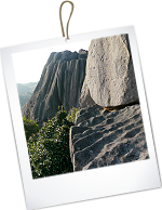
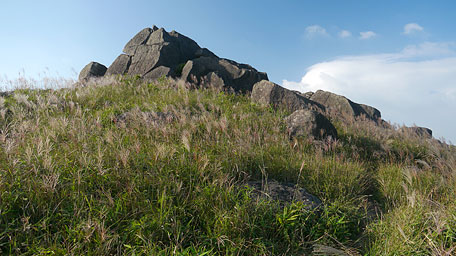
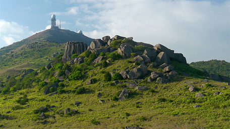
Continue to follow the trail uphill, along the way Square Hill is horizotally towering on the right far, in which Wong Mo Stream embedded itself. Passing through some rocky groups along the ridge, you could see a rocky group in larger scale ahead at the top of Wo Yeung Shan - just Wo Yeung Rocky Group. At that time, the real hilltop of Tai Mo Shan could be also seen behide Wo Yeung Shan. Because only the hilltop of Wo Yeung Shan appears if looking up from Shing Mun Reservoir and Kwai Chung, it is also known as 'Fake Tai Mo Shan'. Afterward, head the trail to approach them and have a look, some of the large rocks are towering with imposing aura. Some of the surfaces appear in wave form and some of the shapes are peculiar. Especially a large rock with vertical pit patterns like a huge cube on the left of the group is known in chinese as 'A stage for appointing a general for a task'. In addition, there are some side-paths in front of the rocky group to climb them. But the access to the top of the 'stage' will detour to the rear of it then climb. Afterward return to the main path.
Miu Ko Toi (Fire Lookout)
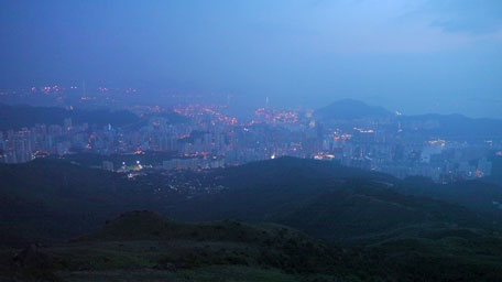
Continuing on along the main path, it slightly undulates and winds along the hillside roughly toward the west. Not far ahead, there is a clear branch on the right uphill leading to another rocky group toward the top of Tai Mo Shan, at that time take the left path. Afterward, the trail cuts through some shrublands and crosses some brooks then leads to a small square pool on the ground, known as 'Sky Pool'. Still go ahead, it then comes to the fire outlook where is also the highest point of Miu Ko Toi. It is one of the south branches of Tai Mo Shan there parallel to the ridge of Wo Yeung Shan that also stretches to the south. Overlook from the fire lookout, the urban districts in wide range beneath the hills even far to Lantau Island are all within the sight. To the northwest, it offers a distance view on Pat Heung, Yuen Long and Shenzhen of China. During the sunset, the colours of the sky changes from yellow-orange gradually to dark blue in the thin haze as if everything become mysterious, remote then silent.
Afterward, follow the downhill path on the left of the fire lookout, it is quite steep initially. Descend to the grassland, it turns gentle then still follows the main path downhill toward the south. After descending the concrete steps through Heung Shek Cemetery, the trail comes to the pavilion beside the road. Trace the concrete path ahead across the road, it leads to Tai Mo Shan Country Park Chuen Lung Management Office. Finally, follow the main road to the right until the minibus terminal at Route Twisk.![]()
Exit: From the rear of the fire lookout, you could also follow the path northward to join Tai Mo Shan Road (toward the hilltop of Tai Mo Shan), then trace the road down to Route Twisk.
Summary
Tai Mo Shan is a grand and broad hill like the mother earth which can accommodate everything that every rocky group on the hill is presenting their various forms and patterns, the waterfalls and streams are thundering down over cascade, moreover every tree and every blade of grasses could display themselve to be lush and verdant respectively. I think that only being tolerant of diversity can obtain more.
Last Update : 25.11.2016
Suggestions:
Other Informations:

