| The Twins | |
| Distance: 5.2 Km | |
| Duration: 3.0 hours | |
| Diff.: | |
| Scn.: | |
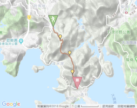
Start: Bus 6, 61, 63, 76 etc. get off at Wong Nai Chung Reservoir, Minibus 5
End: Bus 6, 6A to Central, 73 to Aberdeen and Wah Fu Estate
It is slightly physically demanding for climbing up The Twins with a long and steep flight of steps up and down.
At Tze Kong Bridge (Tsin Tsui Wan Au), there is a sylvan side path on the right that leads down to Repulse Bay.
Due to Google changing the terms of Google Map, the daily usage rate will be limited. Please refer to the static map instead if the above map could not be displayed or used normally. I apologize for the inconvenience.
 Static Map
KML file
Violet Hill
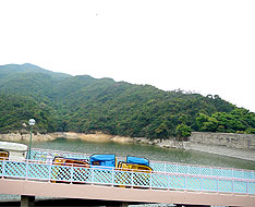
The trail begins from Tai Tam Reservoir Road after taking a short flight of steps up by the gas station at bus stop* of Wong Nai Chung Reservoir Park. Along the road up, it comes to Wong Nai Chung Reservoir on the right. Follow the path on the dam to the right, then take a short flight of steps down on the right at the end of the dam. Heading a short distance, it joins the uphill path on the left. The trail winds up along the ridge and gives a distance view over Wan Chai and Kowloon. Climbing up to the first range pole then going ahead, it comes to the top of Violet Hill. At the hilltop, it offers a panoramic view over Jardine's Lookout and Mount Parker as well as the sublime scenery on southern Tai Tam Reservior.
Related trail: Tsz Lo Lan Shan Trail
* If taking bus from the south district, get off at Wong Nai Chung Reservoir Road, then follow the Wong Nai Chung Reservoir Road to the upper right opposite the bus stop.
Tze Kong Bridge (Tsin Tsui Wan Au)
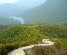
Continuing on along the trail, it soon joins Wilson Trail to the right at the junction. Along the way, Tai Tam Reservoir nestled by the steep valley could be seen in the distance. By presenting the jade screen from the tender leaves of the lush shrubland over the hillsides, the nature shows its vitality. Afterward, the trail follows the flight of steps downhill. At the moment looking far forward, The Twins just towers in the front with the long flight of steps that straightly pushes to the top. To the right, Repulse Bay could be seen. Along the steps, it leads down to Tze Kong Bridge in the valley.
Exit: At Tze Kong Bridge (Tsin Tsui Wan Au) opposite the catchwater, there is a sylvan side path on the right that leads down to Repulse Bay.
Branch: At Tze Kong Bridge, if not climb The Twins, you could take the path to the right along the catchwater and the hillside to Stanley Gap Road.
The Twins
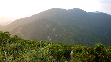
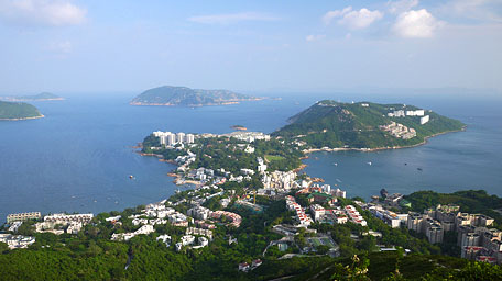
Along the trail ahead, it joins a long flight of steps. It is quite steep in the initial leg and turns gentle later. Further up, you could look back Violet Hill. After climbing up to the first hill, the trail follows and contours along the ridge ahead undulately, then comes to the summit of main hill of The Twins. At the hilltop, the hill range of Dragon Back and Mount Parker could be seen toward the east and the northeast respectively. Afterward, trace the trail downhill. Along the way, it provides a splendid full view over the peninsula of Stanley. Looking far, the blue skyline and the horizon of sea level are seemed to be merged. After joining the concrete steps, it leads down to Stanley Gap Road.![]()
Branch: When arriving at Stanley Gap Road, you could also go to Stanley along the road, but be careful that there is no footway in part of the section.
Summery
Although the hills in Hong Kong Island is not high, climbing up Violet Hill and trekking the long flight of steps up and down for The Twins are also slightly physically demanding. It however rewards you the peaceful country setting and the splendid natural views over the rolling hills and the blue sky and sea.
Last Update : 31.05.2015
Suggestions:
Other Informations:


