| Cheung Chau | |
| Distance: 14.0 Km | |
| Duration: 5.5 hours | |
| Diff.: | |
| Scn.: | |
Start: Ferry from Central to Cheung Chau, or ferry for inter-island between Mui Wo, Chi Ma Wan and Ping Chau
End: Same as above
Entering Cheung Po Tsai Cave requires torch or other tool for lighting.
At Tung Wan or along Cheung Chau Peak Road, there are some side paths leading down to the pier.
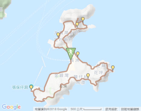
Due to Google changing the terms of Google Map, the daily usage rate will be limited. Please refer to the static map instead if the above map could not be displayed or used normally. I apologize for the inconvenience.
 Static Map
KML file
Tai Kwai Wan
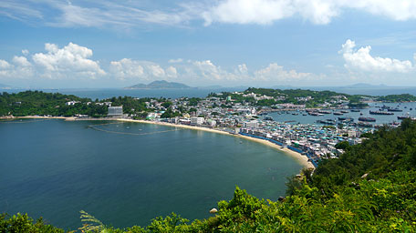
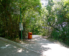
The trail starts by following San Hing Praya Street to the left along the coast from the pier. Heading to the junction of Ping Chong Road, it runs the left coastal path (You could also still follow Ping Chong Road) then joins Cheung Kwai Road after the right turn, which leads to Tai Kwai Wan. Along the coast, it gives the sublime scenery over Chi Ma Wan Peninsula at the opposite coast and the imposing hill of Lin Fa Shan in Lantau Island. After passing through the wooded path, the trail turns right at the junction to follow Cheung Pak Road leading to Tung Wan Tsai.
Tung Wan Tsai
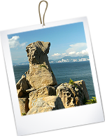
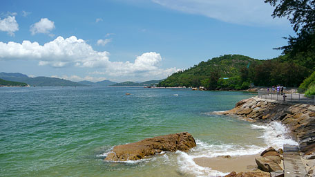
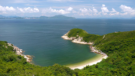
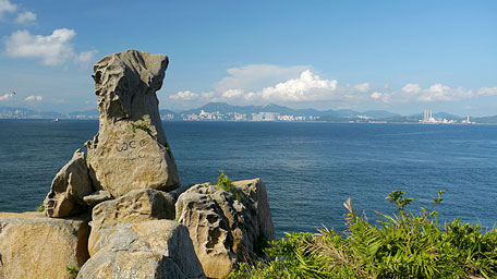
Head the trail along Cheung Pak Road, it gently ascends. Further up, it follows the flight of steps up on the left, then traces the path to the left. Not far ahead, the rock like an eagle head could be seen forward. There is the flight of steps on the right that leads down to Tung Wan Tsai. For the time being, ignore it and go ahead along the hillside, the trail then runs the muddy path also known as ‘Lolex Path’. Afterward, the large rock which shape seems to be a head of an orangutan is at the front by the path. Further ahead a bit, it opens up. Looking down eastward, the splendid view on the beach of Tung Wan Tsai and the cape of Pak Kok Tsui, even far to Hong Kong Island and Lamma Island in a clear day, could be seen. It presents blue sky, emerald sea waters, green hills and rises sea breeze in the early summer, all of which fashion a spectacular picture. Afterward, retrace the way and descend the left flight of steps to Tung Wan Tsai.
Lookout Pavilion
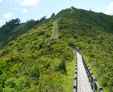
Follow the trail at the end of the beach on the right, it then ascends the flight of steps along the ridge up to the pavilion at the mid-level. Further up, it comes to Lookout Pavilion. At the highest level of Cheung Chau, it offers a full view over Tung Wan and the south of the island. The scenic landscape, the cicada sound around the hills and the hustle from the township beneath the hills blends harmoniously with their surroundings in the island.
Tung Wan and Kwun Yam Wan
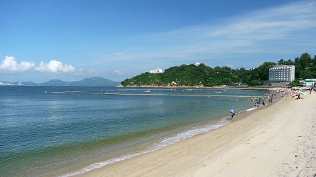
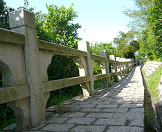
Follow the trail ahead from Lookout Pavilion, it is slowly down. Beyond the park with a pavilion, it joins the concrete path ahead. Head the path, it descends to Pak She Cheung Lee Playground. From there, it takes the left flight of steps down to Tin Hau Temple and then traces the right fork to Pak Tai Temple. Afterward, follow Pak She Street ahead beside the football court, then turn left at the crossing of Kwok Man Road leading to the beach of Tung Wan. Head the trail to the right along the beach to the end, it then joins the coastal path that leads to Kwun Yam Wan. Along the trail, it turns right to follow the uphill path beside the area of open showers. At the next junction, it heads Ming Fai Road on the left then soon joins the left path paved well by stones, known as Small Great Wall.
Small Great Wall and Nam Tam Wan
Along the Great Wall ahead, you could look back far to Tung Wan and Kwan Yam Wan. As there are some famious peculiar rocks distributed on the hillsides and at the coast nearby, some information boards for the guidance about them are set up along the path. Head to the end of the Great Wall, Jade Seal Rock could be seen.
From there, retrace the way to the junction, then ascend the flight of steps on the left which leads to Fa Peng. After passing through the wooded path, the trail follows Don Bosco Road on the left at the junction by the entrance of Fa Peng Knoll (heading forward could return to Tung Wan via Fa Peng Road). Along Don Bosco Road, after passing Salesian Retreat House, it descends the left side path to Nam Tam Wan at the junction according to the signpost. Go ahead along the coast, it comes to Nam Tam Garden in front of Tin Hau Temple.
Reclining Rock and Cheung Po Tsai Cave
Head the path beside the temple, it soon ascends the flight of steps on the right and then follows the concrete road to the left. After joining Cheung Chau Peak Road, trace it to the left, then come to Tin Fuk Pavilion after passing some houses. Along it heading to the junction, then follow Cheung Chau Peak Road West on the left (Going forward will be down to Sai Wan Road and then via Chung Hok Road on the right, leads to the coast and returns to the pier). Passing through the cemetery, it follows the left side path at the junction that leads down to Pak Tso Wan.
Exit: Along Cheung Chau Peak Road, there are some side paths on the way leading down to the town of Cheung Chau.
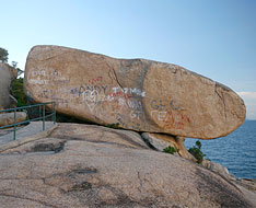
Winding along the coastal path, it comes to Reclining Rock, the five large rocks eroded, the largest of which lies on the rocky shore. However, they have suffered severely by the scribbles. Afterward, descend to Po Yue Wan where is a rocky shore and deviate from the concrete path, then climb over the rocks along the shore. The trail still follows the coastal path ahead, then passes through the aperture between the rocks and soon joins the path which leads to Cheung Po Tsai Cave if head it to the left toward the seaside. Trace the path to the right, it passes the public toilet and then descends to the coast. Finally follow Cheung Chau Sai Tai Road along the west coast to the pier.![]()
Note: Lighting tool should be prepared before entering Cheung Po Tsai Cave.
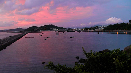
The sunset glow
Summary
Cheung Chau is not large but it is the most crowded outlying island in Hong Kong and always hustle and bustle. However the most striking and invaluable things are its majectic landscapes and peculiar rocks.
Last Update : 26.02.2016
Suggestions:
Other Informations:

