| Pui O | |
| Distance: 9.5 Km | |
| Duration: 3.5 hours | |
| Diff.: | |
| Scn.: | |
Due to Google changing the terms of Google Map, the daily usage rate will be limited. Please refer to the static map instead if the above map could not be displayed or used normally. I apologize for the inconvenience.
 Static Map
KML file
Mui Wo
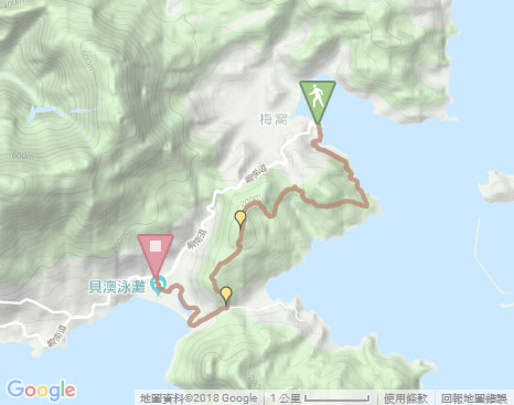
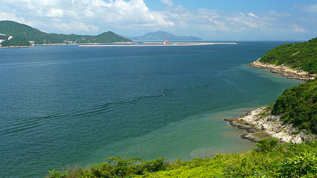
Heading to the left along the coast from the pier, the trail begins by following Mui Wo Ferry Pier Road. After the left turn, it soon comes to the entrance of Lantau Trail on the right ahead. Trace the trail, it starts the smooth concrete path. Along the way, Hei Ling Chau and West Lamma Channel could be seen in the distance, and even far to Hong Kong Island and Kowloon in a clear day. Moreover, in the sunshine, it also offers the picturesque scenery over the indented rocky shores and the shallow coves. Gently up to the junction, it takes the right uphill path heading to the pavilion. (Going forward could lead to Chi Ma Wan Road via Shap Long)
Tai Ngau Wu Teng
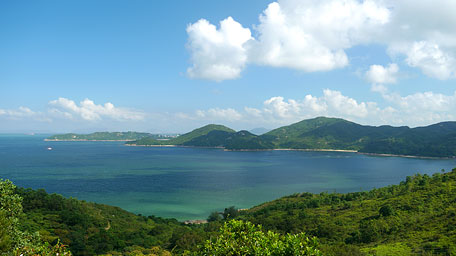
From the pavilion, continue on along the muddy path uphill, it becomes smooth later. Along the hillside, it gives the stunning view over the green hills and the emerald sea waters near the inlets. Afterward, it joins the concrete road and then follows it to the right toward the way of Pui O. Heading to the junction, it runs the Lantau Trail (signpost L133) on the left. Passing through Pak Fu Tin Barbebue Site, it ascents the flight of stone steps to the junction in front of Pak Fu Tin Camp Site, then follows the right path. Up ahead, after cutting through the thick woods and the forestation area, it takes the flight of steps up to the hilltop of Tai Ngau Wu Teng. Afterward, head the trail downhill, it opens up along the way. At the initial leg of the downhill, you could overlook Lo Yan Shan ahead, gaze down the beach of Pui O and the villages beside it. Moreover, Chi Man Wan and Shap Long are within the sight in later section. Further down, it descents to Chi Ma Wan Road.
-
Exit:
- At the junction of L133 signpost, you could follow the road leading to South Lantau Road.
- At the junction of L130 signpost, there is a side path that leads down to South Lantau Road.
Pui O
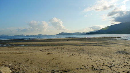
Along Chi Ma Wan Road to the right, it leads to the beach of Pui O. In the sunset, the wide beach is flashing on the golden surface of the crystalline waters. Some of the tourists at the shore for fun could be seen. Afterward, head the concrete path, it then follows alongside the pond and the river. The scenic view of the inverted image on the peaceful water surface from the pond feast your eyes. Further ahead, there are also mangroves along the shallow water shore. After passing through the houses and the football field, it arrives at the bus terminal of Pui O.![]()
Summary
Climbing Tai Ngau Wu Teng offers the splendid full view over Pui O and the jade screen of Chi Ma Wan, as well as the coastal scenery at the beginning leg. The trail offers the excellent landscapes but is not difficult for a walk.
Last Update : 06.09.2015
Suggestions:
Other Informations:


