| Lo Yan Shan | |
| Distance: 12.5 Km | |
| Duration: 5.5 hours | |
| Diff.: | |
| Scn.: | |
Due to Google changing the terms of Google Map, the daily usage rate will be limited. Please refer to the static map instead if the above map could not be displayed or used normally. I apologize for the inconvenience.
 Static Map
KML file
Chi Ma Wan Country Trail
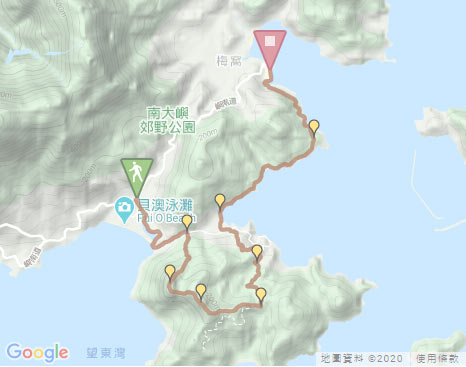
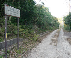
From the bus station of Lo Wai at Pui O towards the way of Tai O, go ahead a short distance along South Lantau Road, then follow the left short flight of steps down according to the signpost to the way of Shap Long and Ham Tin. After crossing the bridge, follow Chi Ma Wan Road alongside the river. Further ahead, the hill of Miu Tsai Tun is rearing up alone in the front. Afterwards, the trail is gently up to the entry of Chi Ma Wan Country Trail on the right.
Miu Tsai Tun
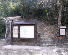
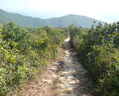
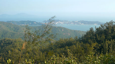
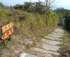
Passing through the archway, follow Chi Ma Wan Country Trail by starting the flight of steps upwards beside the map board according to the signpost to Lo Yan Shan. The path is slowly up along the ridge. Along the way, you could overlook Chi Ma Wan and Shap Long San Tsuen at the east coast of Chi Ma Wan Peninsula. Further up ahead beyond the rocky section, it leads up to the hill of Miu Tsai Tun which is also the secondary peak of Lo Yan Shan.
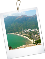
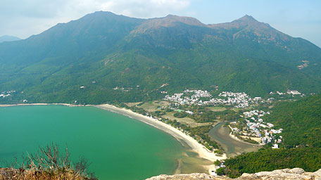
At the summit, there is very open like a natural lookout. Gazing down at the north, it offers the full view over the beach of Pui O which coastline swings westwards to Cheung Sha, that become a spectacular picture with the hills towering behind it. Overlook to the north rolling and undulating peaks, they are even far higher like a huge screen, from the right to the left, which are the hills of Lin Fa Shan, Yi Tung Shan, Sunset Peak and Lantau Peak respectively. Even standing at the top of Miu Tsai Tun, at that time I become tiny.
Lo Yan Shan
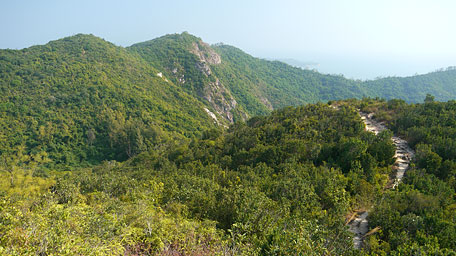
Continuing on along the trail, it roughly undulates towards the southeast. Afterwards, the hill in the front adjacent to Lo Yan Shan could be seen. Overlooking to the cliffs and the craggy rocks at the west hillside of Lo Yan Shan, they emit the mighty aura. Head the trail, it descends to the valley in the woods, sharply turns uphill then leads to the fire lookout at the top of Lo Yan Shan. Look back to the Miu Tsai Tun, the hills of Sunset Peak and Lin Fa Shan behind it seem to be the huge sea wave pouncing on here. Overlooking eastwards to the sea around, Hei Ling Chau and Cheung Chau could be seen on the left and right respectively. Further looking far, Hong Kong Island is very indistinct.
Shap Long Irrigation Reservoir
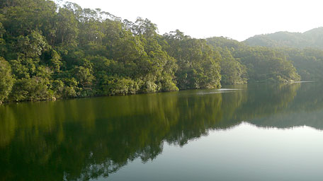
Continue to head Chi Ma Wan Country Trail downhill, then follow the right path to Lun Mei at the junction. (Taking the left Chi Ma Wan Country Trail could directly go to Shap Long Irrigation Reservoir.) After descending to the junction at Lung Mei, follow the left path by the signpost to Chi Ma Wan Country Park Management Centre. Heading to the junction along the concrete path, take the left path by the arrowhead signpost. At the next junction, descend the flight of concrete steps on the left, it leads to the dam of Shap Long Irrigation Reservoir. Looking around, the water surface nestled and surrounded by the greenwood seems to be a mirror reflecting the clear inverted images.
Branch: As downhill from Lo Yan Shan, if not go to Lun Mei, you could directly go to Shap Long Irrigation Reservoir by taking the left Chi Ma Wan Country Trail from the junction.
Shap Long San Tsuen and Chi Ma Wan
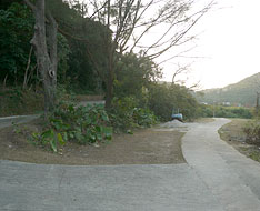
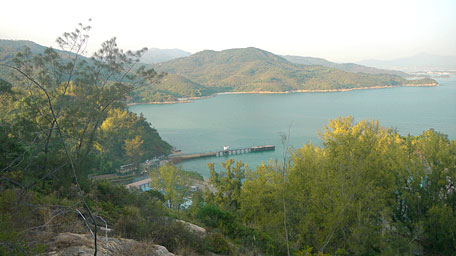
Passing through the dam, the trail joins Lantau Forest Track. Head it to the left a short distance, then turn left to trace the muddy path upwards. It is quite steep only at the beginning and becomes smooth in the later section through the woods. Along the way, Chi Ma Wan Pier could be seen far from the coast. Head to the junction then follow the mountain bike trail to the right. After coming to the next junction, follow the right path downhill. (Taking the left path could be leaded to return the archway of the starting point of Chi Ma Wan Country Trail.) After cutting through the woods, it leads down to join the concrete path, and then further goes downwards through the village houses until coming to Chi Ma Wan Road.
Afterwards, follow Chi Ma Wan Road to the left. Head to the junction then take the right path. (Taking the left path could return Pui O.) Along the path, it leads to the coast of Chi Ma Wan beside Shap Long San Tsuen. Looking around, it seems to be nobody over there including the beach, the grassland and the village houses. But there are a few cattle eating grasses leisurely. The sea breeze breaks the silence but the sounds of the small sea waves with a regular pattern like crying makes you more lonesome.
Continue to head the concrete path, after pass through Shap Long Heung Kung Sho then follow the right concrete path at the junction of Shap Long San Tsuen. It winds along the hillsides roughly contouring the coast. Along the way, you could look back far to Lo Yan Shan. After join the muddy path, head it to the junction of Lantau Trail, then follow Lantau Trail ahead to Mui Wo by the signpost. The trail still winds the hillsides, afterwards, it joins the concrete path leading to Mui Wo Ferry Pier Road. Finally, trace the road to the left then head to Silvermine Bay Ferry Pier along the coast.![]()
Branch: After passing through the dam of Shap Long Irrigation Reservoir and following Lantau Forest Track, if not take the muddy path, you could still follow Lantau Forest Track to join Chi Ma Wan Road, then head it to the left to Shap Long San Tsuen via Chi Ma Wan Correctional Institution.

Look back the silhouette of Lo Yan Shan
Summary
It is impressive and charm for the emerald waters of the coast of Pui O and the rolling hills of Sunset Peak and Lin Fa Shan. The hills of Miu Tsai Tun and Lo Yan Shan are not high, but they offer the splendid mountain and coastal scenes. The pictures are still in mind after the hike.
Last update : 09.10.2020
Suggestions:
Other Informations:

