| Grassy & Niddle Hill | |
| Distance: 12.0 Km | |
| Duration: 4.0 hours | |
| Diff.: | |
| Scn.: | |
Start: Minibus 23K from Tai Po Market Station to Wun Yiu. Or take around 15 mins walk to there from the station
End: Minibus 82 at Shing Mun Road to Tsuen Wan
It is slightly physically demanding for the certain distance.
After the downhill from Grassy Hill and before the climb to Needle Hill, there is a side path on the left that leads down to Sha Tin.
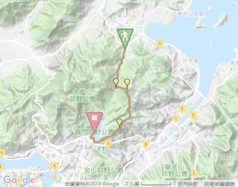
Due to Google changing the terms of Google Map, the daily usage rate will be limited. Please refer to the static map instead if the above map could not be displayed or used normally. I apologize for the inconvenience.
 Static Map
KML file
Wun Yiu
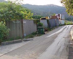
The trail starts by following TaT Wan Road ahead and then beginning a gentle ascent along Wun Yiu Road. Head to the junction, take the path to Lead Mine Pass according to the signpost, then follow the left path at the map board of Wilson Trail. At the next junction, trace the right fork to ascend. Afterward, it joins the flight of uphill steps on the right along Wilson Trail. Head the trail up, its ascent is quite long but not steep that cuts through thick woods in later section. Along the way, you could look back Tai Po, and overlook the hills of Ping Fung Shan and Wong Leng in the distance. Further up, it reaches Lead Mine Pass.
Lead Mine Pass
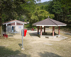
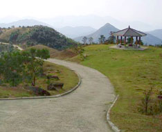
Lead Mine Pass is a recession of the range of the hills between Tai Mo Shan and Grassy Hill. It opens in all directions, that heading westard could climb Tai Mo Shan; descending to the south could lead to Shing Mun Reservoir; running eastward could go to Tai Po Kau or climb Grassy Hill. Afterward, trail follows the concrete road at the left of the pavilion according to the signpost to Tai Po Kau. Heading to the junction*, then take the left path. Trace it ahead a short distance, it soon starts the flight of uphill steps of MacLehose Trail on the right.
* At the junction, if you follow the path to the right according to the direction as indicated from the signpost "Grassy Hill and Needle Hill", it does not climb up to the hilltop of Grassy Hill that just winds along its hillside. However, if not to climb Grassy Hill, you could trace it.
Grassy Hill
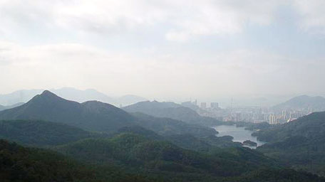
Ascend the steps, it gradually opens up. Looking back far, it is admirable for the lofty Tai Mo Shan, with the grandeur of the mountain, which form and range are enormous. Gazing to the right, the splendid view over Needle Hill and Shing Mun Reservoir could be seen. Further up, the trail turns gentle and joins the concrete road later. Heading to the junction, it leads up to the top of Grassy Hill along the left path, till the range pole built on the rock. At the hilltop, it offers a sublime panormaic view, northward to Tai Po and Pak Sin Leng, eastward far to Ma On Shan, even over south Kowloon peaks and Tsuen Wan. Afterward, return to the junction, then follows the concrete road downhill, with the view overlooking Sha Tin and Tai Wai. Descend to the junction, take the left path. Further down to the next fork, it follows the left path to Needle Hill.
Needle Hill and Shing Mun Reservoir
Along MacLehose Trail, the gentle wooded path, past the junction of left path leading to Sha Tin, go ahead. Needle Hill is just towering in the front. Head to the end of the concrete road, it joins the uphill path and then starts the flight of well paved steps. Up the trail, it soon reaches to the top of Needle Hill. A full view on Upper Shing Mun Reservoir and far to Kwai Chung could be seen at the top. Afterward, continuing on along the trail, it descends along the ridge. Beyond several hillsides, it leads down to Shing Mun Reservoir.
Exit: If not to climb Needle Hill, you could take the left path to Sha Tin at the junction after the downhill from Glass Hill.
Follow the concrete road to the left skirting the reservoir. After passing the main dam, go ahead. Through the large barbecue site, it still heads the road until arrives at the minibus station at the junction of Shing Mun Road.![]()
Summary
Climbing Grassy Hill and Needle Hill offers the splenedid full view over the surrounding remote hills in middle of New Territory. It is impressive for the grandeur of widely towering Tai Mo Shan, for gazing up at the sharp peak of Needle Hill, and for the jade screen over Shing Mun Reservoir nested among the thick forest.
Last Updated : 16.08.2015
Suggestions:
Other Informations:

