| Tai To Yan | |
| Distance: 10.0 Km | |
| Duration: 4.0 hours | |
| Diff.: | |
| Scn.: | |
Due to Google changing the terms of Google Map, the daily usage rate will be limited. Please refer to the static map instead if the above map could not be displayed or used normally. I apologize for the inconvenience.
 Static Map
KML file
Kadoorie Farm
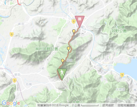
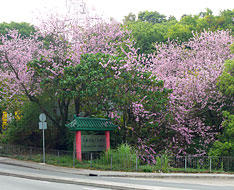
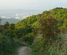
The trail begins from the left of the map board behind the bus stop (the way to Fanling at Lam Kam Road) opposite Kadoorie Farm. Head the trail, not far ahead at the junction, take the uphill path on the left. It initially climbs up steadily with a flight of stone steps but under the shade trees. Further up, it gradually opens up that Kam Tin, Pat Heung and the towering Tai Mo Shan could be seen.
Tai To Yan and Pak Tai To Yan
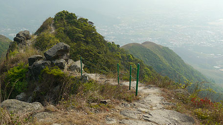
Following and contouring along the undulated ridge uphill, the trail will soon come to the "knife blade" section that becomes narrow and runs over rocks in part along the cliffs on the both side, but there are also some railings at the edge. Look back the undulated rolling ridge that looks like the tail of a huge dragon stretching to Kim Tin and Pat Heung, it is admirable for the grandeur of the mountain. At the hilltop, you could see another "huge dragon" - Kai Kung Leng at the northwest, as well as overlook Pat Sin Leng and Ma On Shan in a clear day. Continue on along the trail roughly toward the northeast. Through the rugged ridge, it comes to Pak Tai To Yan. At its top, it offers a distant view on Sheung Shui.
Exit: Before climbing Pak Tai To Yan, there is a side path on the left leading down to Ta Shek Wu.
From Kei Lak Tsai to Fanling
Follow the trail downhill. It descends from Pak Tai To Yan, than cuts through the thick woods. Afterward it joins the concrete path for morning exercise named Wu Tip Shan path. Along the way, there are some pavilions. One of the lookout pavilion could give a full view over Sheung Shui and Shenzhen of China. Head the concrete path, then take the left fork at the junction that leads down to Fanling Railway Station.![]()
Summary
Climbing up Tai To Yan, it offers the panoramic sublime scenery over Kam Tin, Pat Heung and Tai Po, and the imposing views from the lofty Tai Mo Shan and Kai Kung Leng with board hill range, as rewards for the slightly strenuous hike.
Last Update : 17.05.2015
Suggestions:
Other Informations:


