| Tai Yue Ngam Teng | |
| Distance: 11.0 Km | |
| Duration: 6.0 hours | |
| Diff.: | |
| Scn.: | |
Start: Village Bus 29R, Get on at Chan Man St. in Sai Kung Town
End: Taxi (could be called at the east dam to Sai Kai Town)
1.Climbling up and down near the top of Tai Yue Ngam Teng would slightly clamber.
2.The initial section from Long Ke Tsai to Long Ke Wan is rocky and steep.
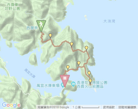
Beyond the pavilion of Sai Wan, you could follow MacLehose Trail ahead to Long Ke, if not go to Tai Yue Ngam Teng.
Due to Google changing the terms of Google Map, the daily usage rate will be limited. Please refer to the static map instead if the above map could not be displayed or used normally. I apologize for the inconvenience.
 Static Map
KML file
Sai Wan Shan
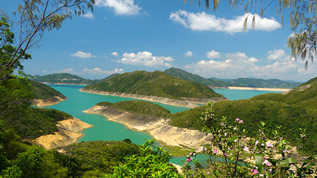
The trail begins from the pavilion of Sai Wan and then goes on along MacLehose Trail ahead according to the signpost to Sai Wan. By initially skirting High Island Reservoir, it gives a scenic view on its emerald water surface. Afterward, it is slowly up to the junction at Chui Tung Au. Follow MacLehose Trail to Long Ke on the right. Up ahead along the way, Sai Wan could be seen on the right far. Winding up to the lookout of Sai Wan Shan, it offers the sublime panoramic scenery over the four beachs of Tai Long Wan with the Sharp Peak as a background. Head the trail not far, it comes to the pavilion at the hilltop of Sai Wan Shan.
Related route: Long Ke Wan
Tai Yue Ngam Teng
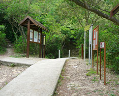
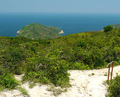
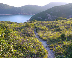
Head the trail down not far, it soon takes the left side path (its entrance is just oppsite to a signpost of MacLehose Trail) that is obvious. There are also some ribbons as marks for guidance at its entry and along the way, but part of the sections cut through the thick woods. Along the path down, you could see the hill of Tai Yue Ngam Teng near the coast. Descending to the slightly obscure junction, take the left fork. Through the thickets, it opens up that the pathway to the hill could be clearly seen. Further down, it turns gentle and comes to the grassy patches. At that time, you could overlook the beach of Long Ke Tsai from there. In the sunshine, it is enjoyable in the country setting with the lush greenery, the birdsong and the fragrant flowers on the hillsides. Head to the junction, then go ahead. Afterward, it winds gently up and climbs to the hilltop along the ridge beyond the hillside.
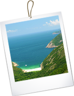
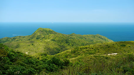
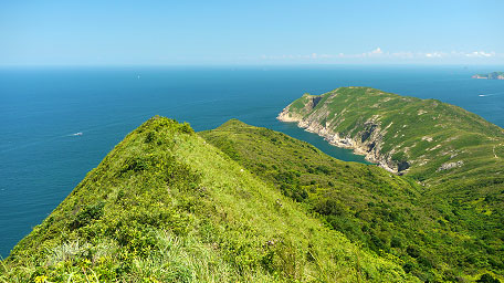
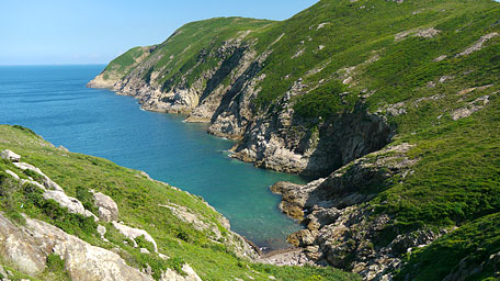
At the top in one of the three sharp peak in Sai Kung, it opens up among the splendid scenery. Toward Pacific Ocean, the unbounded horizon could be seen. Overlooking Sharp Peak (Nam She Tsim), it offers a sublime view on the beaches of Tung Wan, Tai Wan and Ham Tin Wan below the hill. Gazing down to the south, the headland of Tsang Pang Kok is stretching to the sea and the indented rocky shoreline edges the sea.
Cheung Ngam Teng and Tsang Pang Kok
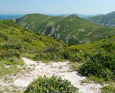
Keep on along the trail ahead, it descends along the ridge. Although it is narrow and covered loose gravel in part, it is not too difficult. Down to the junction on a small open flatland, take the right fork (with ribbon as a mark). It leads down toward Cheung Ngam Wan, but turns steep in latter leg. Along the way, you could see the offshore cliffs below the hill of Cheung Ngam Teng, but it was quiet along the coast at that time. After the downhill, it crosses the brook and then follows the left path uphill. It is rugged and steep a little that would clamber. Up to the top of the ridge, take the left path that leads up to the top of Cheung Ngam Teng.
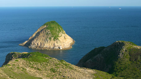
Past Cheung Ngam Teng, head the trail down. Passing through the smooth grassy section, it gently descends along the hillside where Conic Island off Tsang Pang Kok Teng could be seen ahead. Follow the path down along the ridge, it finally reaches the end of the cape, where is peaceful and seems to be a uninhabited place as the ends of the Earth.
Long Ke Tsai and Long Ke Wan
Retrace the way to Cheung Ngam Teng. After the descent from Cheung Ngam Teng, it soon reaches the left path junction on a small flatland that leads down to the small beach of Long Ke Tsai. Head the side path, it becomes steep slightly at the latter section. Down to the beach, there is a path ahead at the opposite rocky slope at end of the beach near the outfall of a stream. It also has some ribbons as a mark attached at the upper strubbery. Clamber up the rocky slope, then it soon joins the narrow but smooth wooded path skirting along the offshore hillside. You could look back the scenic view on the beach and far to Tsang Pang Kok on the way. Approaching to Long Ke Wan, take the left rocky path that is very steep and sharply and straight leads down to the beach. Approach the right side along the beach, it joins MacLehose Trail in the woods. Afterward, follow it to the east dam of High Island reservoir.![]()
Note: Taking the path from Long Ke Tsai to Long Le Wan requires to clamber up and down at the both ends.
Summary
At Tai Yue Ngam Teng, the four famous white sand beaches and the Sharp Peak in Sai Kung could be seen surprisingly from an unique angle. In additions, it is remarkable for the peninsula of Tsang Pang Kok like a huge whale, and at the extreme of its headland as if it was at the end of the Earth. However, the trail is slightly long and rugged in part with less shade trees along the way, recommend to equip well before setting out.
Last Update : 26.07.2015
Suggestions:
Other Informations:

