| Jardine's Skyline Path | |
| Distance: 6.5 Km | |
| Duration: 3.5 hours | |
| Diff.: | |
| Scn.: | |
Start: Bus 6,63,76 get off at Wong Nai Chung Reservoir Park station, or Tai Tam Reservoir Rd station (way to Central)
End: Bus and MTR to all districts
The path between the south catchwatch and Jardine Skyline Path is quite rugged and steep that requires you clambering.
Details as below
Due to Google changing the terms of Google Map, the daily usage rate will be limited. Please refer to the static map instead if the above map could not be displayed or used normally. I apologize for the inconvenience.
 Static Map
KML file
Wong Nai Chung Gap Trail
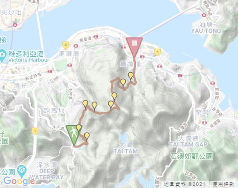
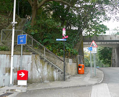
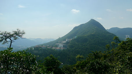
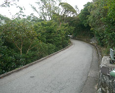
From the bus station of Wong Nai Chung Reservoir Park (the way to Repulse Bay), the trail starts by ascending the short flight of steps ahead beside the gas station, then following Tai Tam Reservoir Road to the left upwards. Along the way, Wong Nai Chung Reservoir could be seen on the right. Up to the outdoor car park on the left near Hong Kong Parkview, turn left to follow Wong Nai Chung Gap Trail beside the map board at the entry. Head the concrete path according to the signpost to Station 3 of the trail, not far ahead, turn left at the junction then descend a short flight of steps to join the path alongside the catchwater. It swings along the hillsides through the woods. Along the way, it could overlook the east ridge of Mount Nicholson, which is quite sharp and seems to emit the mighty aura. After come to the cross-junction of Wong Nai Chung Gap Trail, still follow the path ahead along the catchwater. Head to the end of the concrete path at the sighpost of Jardine’s South Catchwater, it then joins the muddy path behind the signpost.
Jardine's Skyline Path
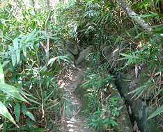
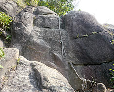
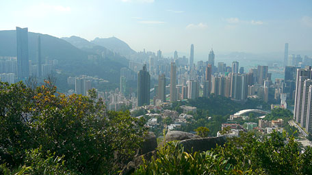
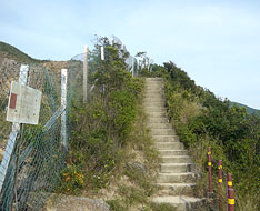
Along the path up, it is obvious but quite steep that would partly requires clambering over the slopes or the rocks sometimes. There are also some ribbons as reference along the way occasionally. Climbing Up to the top of the rock, it seems to be a natural lookout over there where offers you the open view over Tai Hang, Wan Chai, Central and Kowloon. Afterwards, the path descends the steep slope over the rocks. There are some ropes for assistance but not too depend on it. Still along the path, it cuts through the woods. After clambering the very steep slope, you could see the wide but steep rocky slope below which have the short wall built along the edge at the end in order to lead waters to the catchwater. There is also an uphill path of climbing Jardine’s Lookout at the top of the slope.
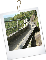
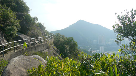
Descend the rocky slope, it then joins the catchwater named as Jardine Skyline Path which is partly bridged the hillsides. Follow the catchwater, the full view of Mount Butler and Tai Hang could be seen along the way. Afterwards, head the concrete path alongside Jardine’s North Catchwater winding along the hillsides. Not far ahead, Siu Ma Shan is horizontally towering at the front and Mount Butler Quarry could also be seen beneath it. Continue on along the path, it ultimately joins Wilison Trail (also the section of Hong Kong Trail).
Note: The path between the south catchwatch and Jardine Skyline Path is quite rugged and steep that requires you clambering.
Exit: If you do not climb Siu Ma Shan, there is the flight of steps downwards on the left leading to Mount Butler Road where could take minibus, when you follow the path alongside Jardine’s North Catchwater after passing through Jardine Skyline Path.
Siu Ma Shan
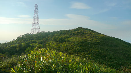
Follow Wilison Trail to the left uphill (right to Jardine’s Lookout), it initially skirts along the quarry then ascends the long flight of steps to the upland. Overlooking to the south from the ridge, the jade waters and the green view of Tai Tam Reservoir feasts your eyes. Head to the junction, take the left path by the signpost to Siu Ma Shan. It is slowly upwards. After passing through the range pole at the hilltop, it turns downhill. Looking far forward at that time, it offers the sublime views over the undulated rolling peaks of Kowloon. Gazing to the right, Mount Parker is just soaring. Afterwards, the trail contours along the north ridge downhill and then descends the long flight of steps, at the same time, the buildings of Quarry Bay and TaiKoo Shing could also be seen on the right. Down to the junction at Siu Ma Shan Bridge, turn right to follow Sir Cecil’s Ride by the signpost. Descend to the next junction, take the right path to Tai Fung Au, it then joins Mount Parker Road.
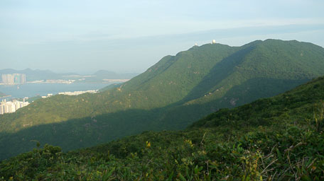
Mount Parker horizontally towering
Quarry Bay Tree Walk
Follow Mount Parker Road to the right upwards not far, it comes to the left junction of Tai Tam Country Park Quarry Bay Management Centre. Take the left concrete path downhill. Passing through the management centre, it joins the muddy path and then leads down to the war relics of the cooking stoves at Quarry Bay Tree Walk. Afterwards, according to the signpost for the way to Kornhill and to trace Quarry Bay Tree Walk, go ahead along the right side of the stove relics until the end, then descend the flight of steps. Down to the junction, take the right path. Head it to the junction of Hong Pak Country Trail, then turn left to Kornhill by the signpost. Finally, it leads to Greig Road then follow it to the left to King’s Road in Quarry Bay.![]()
Branch: You could follow Mount Parker Road downhill to Quarry Bay directly.
Related route : Jardine's Lookout & Mount Butler
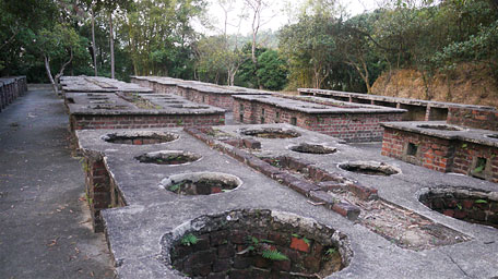
The war relics of the cooking stoves at Quarry Bay Tree Walk
Summary
It is enjoyable for exploring the north hillsides of Jardine’s Lookout and climbing Siu Ma Shan, and for overlooking the full views of the north of Hong Kong Island and the east of Kowloon. Moreover, it is fun for trekking along the steep and rugged path through the hillsides as if it added an exciting melody in a flat music.
Last Update : 16.03.2021
Suggestions:
Other Informations:

