| Nicholson & Cameron | |
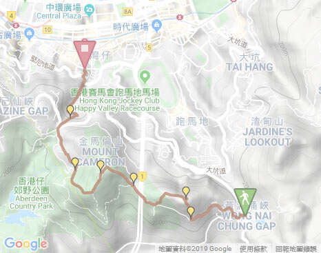
| Distance: 6.5 Km | |
| Duration: 4.5 hours | |
| Diff.: | |
| Scn.: | |
Start: Bus 6,63,76 get off at Wong Nai Chung Reservoir Park station (Repulse Bay direction)
End: Bus and MTR to all districts
The uphill and downhill paths climbing Mount Nicholson and Cameron are rugged, very steep and overgrown that requires scrambling partly.
1. You could skip the section of Mask Rock.
2. If not climb Mount Cameron, you could still follow Black's Link to Stubbs Road for taking bus after the downhill from Mount Nicholson.
Due to Google changing the terms of Google Map, the daily usage rate will be limited. Please refer to the static map instead if the above map could not be displayed or used normally. I apologize for the inconvenience.
 Static Map
KML file
Black's Link
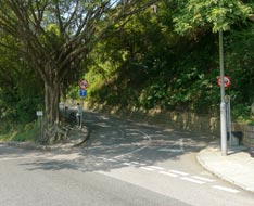
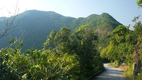
From the bus stop (the way to Repluse Bay) of Wong Nai Chung Reservoir Park, cross Wong Nai Chung Gap Road to the opposite bus stop (the way to Central & Wan Chai). Head to the left a bit, then turn right to Nam Fung Road. Head it a short distances, it then comes to the entry of Black's Link on the right, which is also Hong Kong Trail Section 4. Follow Black's Link gently up, not far ahead, the transmission station at the hilltop of Mount Nicholson could be looked up forward. It then turns one-way after passing through the residential zone. Heading to the large right turn beside the electric tower, pay attention to the rocky slope with gravel on the right. It is just the entry of the uphill path of Mount Nicholson via the south ridge, where could look up straight over the group of Mask Rock.
Mask Rock and Mount Nicholson
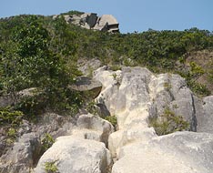
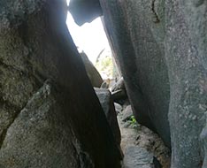
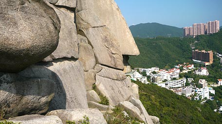
Along the gutter up to the end, clamber up the rocky slope which is initially very steep with gravel. The trail then joins the muddy path through the woods. The path is obvious but quite rugged. Up to the rock with a sharp corner like a bird beak, still go upward. Passing through under the group of Mask Rock, it leads to the position toward the 'left face' of Mask Rock. At the moment, attend to the left rocky slope. Deviate from the main path and climb up the left slope, it leads to the rear 'neck' of the 'left face'. Approaching to the neck, the narrow gap could be seen ahead. By passing the gap, it comes to the right side of Mask Rock. At the time peer at the left, the true colour of the 'right face' appeared with a smile. Standing beside the large face, I also overlooked the same scenery with a smile. Afterward, go ahead along the hillside over some rocks not far, climb up the rocky group on the right, it then joins the wooded path. Head the path, it leads up to the junction of the main uphill path on the small flat land.
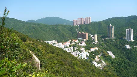
Looking up forward, the summit of Mount Nicholson could be seen. Overlooking to the east, the ridge of left Jardine's Lookout links up to the right Violet Hill, where the buildings of Hong Kong Parkview are standing on the recess of the ridges. Mount Parker is also towering behind them that seems to show the its height with pride. Toward the south, it offers the splendid views over Deep Water Bay, Brick Hill, the southern coasts and the small islands. Afterward, continue to head the main path up, the slope slightly turns gentle. After enter the woods, it soon ascends to the side of the transmission station. You could also skirt along it to the right therefore the range pole of the hill could be seen from the outside. At the time, head the trail to the left not far, it then joins the long flight of the steps to the left downhill that leads to Black's Link.
Note: The beginning of the path climbing Mount Nicholson through the south slope is very rugged and steep that requires you clambering.
Branch: You could skip the section of Mask Rock by still following the main uphill path.
Mount Cameron
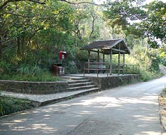
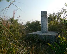
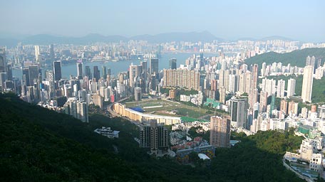
Follow Black's Link to the right, not far ahead, the undulated ridge of Mount Cameron lies on the front, which east ridge is quite steep with strong aura. Afterward, it comes to the junction of Hong Kong Trail on the left where there is the pavilion nearby. Toward the junction of Hong Kong Trail, there is the flight of uphill steps on the right where is just the uphill path of Mount Cameron. Ascend the steps until approaching the end, then follow the wooded muddy path on the left unhill. The path is partly overgrown but still obvious and there is also some old broken pipes on the ground along it, which would require clambering slightly. Up to the knoll, the full view of Happy Valley and the east of Kowloon feast your eyes. Look back far to Mount Nicholson, its lateral side looks imposing. Futher up, it comes to the flat land. Head it a bit, turn left at the junction (downhill if going ahead further). Along the path not far, it leads up to the range pole at the hilltop of Mount Cameron.
Standing in the middle of the hill ranges of Hong Kong Island, it offers the panoramic view around. From the west, other than High West, Victoria Peak, Mount Kellett; to the east, Mount Nicholson, Jardine's Lookout, Siu Ma Shan and Mount Parker, all hills seem to be the chain after chain into the distance. Moreover, the ranges of Violet Hill and The Twins extends to Stanley southward. The horizontal hill range of Hong Kong Island seems to be the natural screen vis-a-vis the north hill range horizontally lying in Kowloon.
Afterward, follow the south path downhill. The path is overgrown but still identifiable. Down to the electric tower, pass through it and then descend the flight of the concrete steps to Middle Gap Road. Head it to the right to Stubbs Road, cross it then follow Wan Chai Gap Road downward. After crossing Bowen Road, still descend Wan Chai Gap Road ahead to Kennedy Road. Finally, cross Kennedy Road and then follow Yen Wah Steps down to Queen's Road East.![]()
Note: The upill and downhill paths of Mount Cameron are steep and partly overgrown that would require clambering slightly.
Exit: If not climb Mount Cameron, you could still follow Black's Link to Stubbs Road for taking bus after the downhill from Mount Nicholson.
Summary
The names of the two hills are full of the colonial colouring, so that let me think of the brilliant period of the colony during the hike. When it had stopped the waltz music, the phoenix over the century discoloured and became the crow gradually. On the hill, there are full of the green woods, beneath the hills, there are the fire beacons on all sides. Hope there could get the glory again.
Last Update : 15.11.2019
Suggestions:
Other Informations:

